http://www.kslb.kerala.gov.in/main.php :
Kerala State Land Bank Online Land Search
Procedure for KSLB Land Searches
Option No. 1:
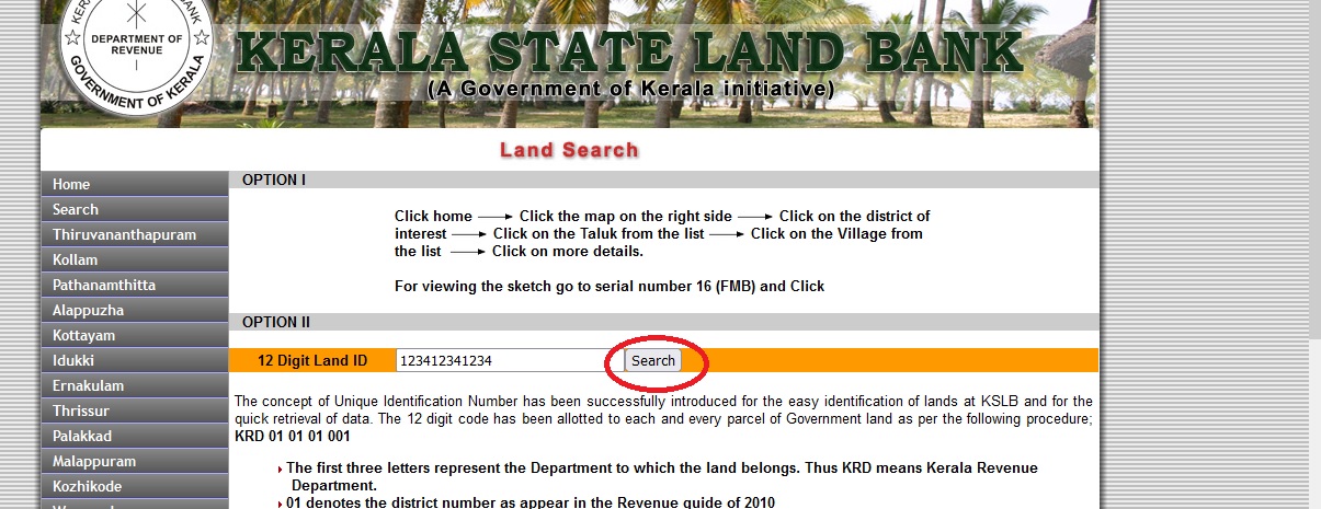
On the right, click the map. Select the district of interest by clicking on it. Select the Taluk from the drop-down menu. Select the Village from the drop-down menu. Go to serial number 16 to see the sketch (FMB)
Option number two:
Step 1: Go to http://www.kslb.kerala.gov.in/search.php and fill out the form.
Step 2: Enter the 12 digit Land ID number.
Step 3: Press the Search button.
At KSLB, the notion of a Unique Identification Number has been effectively implemented for easy land identification and data retrieval. The following technique was used to assign the 12-digit code to each and every plot of government land: 01 01 01 001 KRD
** The Department to which the land belongs is represented by the first three letters. As a result, KRD stands for Kerala Revenue Department.

** 01 designates the district number from the 2010 Revenue Guide.
** The next 01 marks the district’s first thaluk.
** In the revenue guide, the next 01 signifies the first village under that thaluk.
** The number 001 denotes the village’s first land parcel recorded to the Kerala State Land Bank.
As a result, each and every land parcel will have its own UNIQUE ID. The land bank jundas that will be placed at the intersections of these property parcels will have this UID number stamped on them. This number should be used in all discussions with the Kerala State Land Bank for quick data retrieval.
Advantages of the Project
The project’s advantages include:
** Following the successful launch of the project, the government and the general public will be able to identify all of the state’s public lands.
** With the help of useful information from the public, a growing number of government lands will be traced out.
** The data base would serve as a quick reference for the government to plan and construct development programmes without having to go through the costly process of land acquisition.
** Eviction of encroachments on government lands using a People Participatory Eviction Approach
** Lease administration and control from a central location
Inventorization of Public Lands:
This is the method through which government lands are surveyed, and the sketches, as well as other land characteristics, are digitised and saved as a permanent record. The same principle can be applied.
When a reference document for public / official surveillance of Government lands, data will be updated on a regular basis as changes occur. Copies of such documents will also be made available to the respective SROs, allowing any alienations of enlisted lands to be examined at the point of registration of such illegal documents.
About the Authors:
Kerala is the essence of diversity in terms of culture, natural resources, people, and so on. Perhaps no other state in India has been blessed with such a pleasant temperature, beautiful scenery, plentiful water resources, and a diverse human population. Kerala has been establishing itself as a destination for tourism, information technology, and high-tech enterprises, among other things, by utilising the state’s particular resources.
Be the first to comment